United Kingdom (Parliament Politics magazine) – A sudden snow blast is expected to sweep across the UK in the coming days, with three counties predicted to be worst affected, bringing a significant early winter chill. The Met Office has issued weather warnings as temperatures drop and snow showers intensify.
UK Braces for Sudden Snow Blast
The Met Office has forecast a rapid plunge in temperatures accompanied by snow showers expected across the UK within days. Latest weather maps indicate that the counties of Cumbria, North Yorkshire, and Lancashire will be hardest hit by this early-season snow event.
This forecast marks a sharp contrast from the record-breaking summer warmth, signifying an abrupt arrival of cold autumnal and winter weather.
Weather Warnings Issued for Three Counties
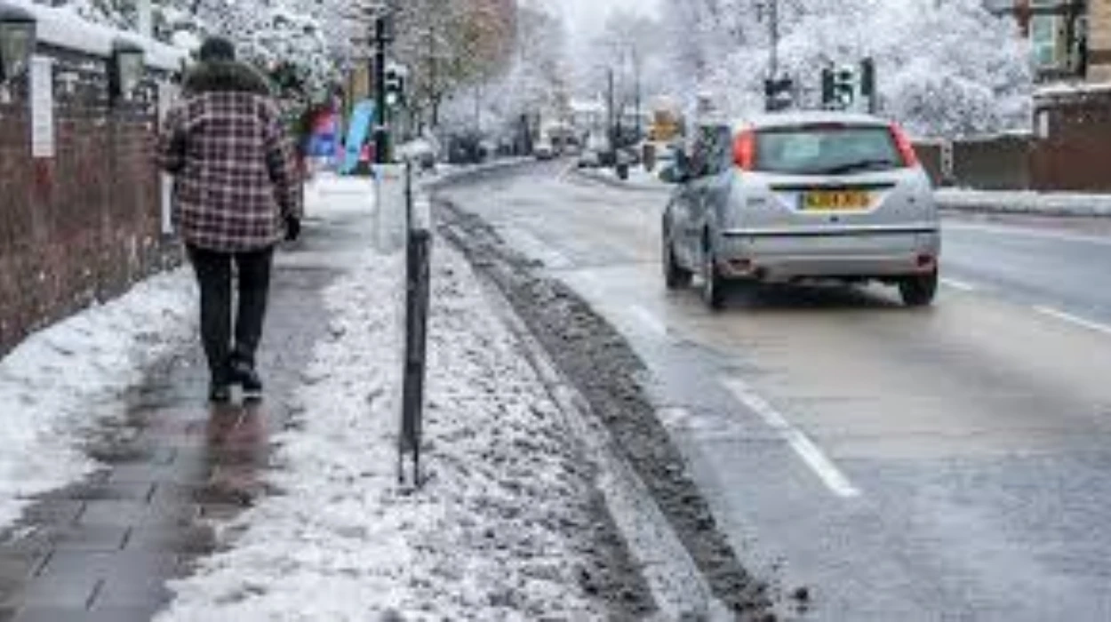
The Met Office has issued Yellow Warnings for snow and ice specifically targeting Cumbria, North Yorkshire, and Lancashire. Residents are advised to prepare for difficult road conditions, possible travel delays, and disruptions to daily activities as surface temperatures are expected to drop below freezing at night.
The warnings also mention risks of localised flooding from rapidly accumulated snow melting during warmer spells.
Impact on Travel and Infrastructure
Authorities warn that roads in the forecasted counties will become icy and slippery, increasing accident risks. Motorists are urged to drive with caution and consider alternative routes or delaying non-essential journeys.
Rail services may face delays or cancellations due to snow on tracks and freezing points impacting signal operations. Airports in the North West could see more flight disruptions due to de-icing needs and reduced visibility.
Expert Meteorological Analysis
Meteorologist Kate Wilson of WX Charts explained,
“A cold Arctic air mass is pushing southwards, displacing warmer air and triggering snowfall especially in the North West and Pennines.”
Wilson noted,
“This is an early taste of winter weather that can sometimes cause more disruption due to reduced public preparedness”.
The blast is associated with a wavy jet stream pattern allowing cold air from the Arctic to dip over parts of the UK while more southerly regions experience milder conditions.
Historical Context of Early UK Snowfalls
Early snow blasts have precedents in UK climate history, often occurring in late September to early October, particularly in higher elevations and northern counties. These events can be severe enough to affect agriculture, transportation, and local economies.
The 2025 early snow marks one of the earliest substantial cold spells following the warmest summer on record, highlighting continued climate variability.
Public Safety Advice
The Met Office encourages the public to stay weather aware by monitoring forecasts closely over the coming days and recommends keeping essentials ready in case of travel disruption or weather-related delays.
Local councils in Cumbria, North Yorkshire, and Lancashire have activated winter response teams equipped to treat roads and manage emergency situations.
Outlook Beyond the Snow Blast
While the snow is expected to be brief, temperatures remain low, increasing frost and ice risk widely across the UK. Southern and eastern regions may experience rainfall and unsettled weather with temperatures slightly warmer but still below seasonal averages.
Experts advise the public and businesses to prepare for continued variable weather as autumn progresses towards winter.
The upcoming snow blast signifies a swift end to the mild summer and a stark introduction to winter conditions for parts of the UK, particularly Cumbria, North Yorkshire, and Lancashire. With weather warnings in place, residents should prepare for icy conditions and travel disruption.
The early snow offers a reminder of the UK’s dynamic climate and the importance of winter readiness even as the nation continues to contend with climate change and weather volatility.