
UK (Parliament Politics Magazine) – Met Office issues rainfall warning as heavy rain and 50mph winds spark 135 flood alerts across southern and western Britain.
As reported by Louis Regan of The Sun, heavy rain and strong winds are set to hit Britain as the Met Office issues two yellow weather warnings ahead of Christmas. The alerts are valid until tonight, alongside 135 flood warnings nationwide.
What warnings has the Met Office issued for rain and strong winds?
The Met Office has issued a yellow rain warning across Cornwall, Devon, Plymouth, and Somerset. South Wales and Dartmoor are expected to experience the heaviest rainfall.
The forecaster released the rain warning at 10 am yesterday, effective until 7 pm tonight, with the UK also facing a series of flood risks across several regions.
A total of 134 alerts were issued by the Met Office, warning the public to take extra care on dangerous roads.
Another yellow warning has been issued for South-East England, effective from 9 am yesterday until 9 pm tonight. Strong winds of 40-50mph inland, reaching up to 70mph near the southern coast, are expected.
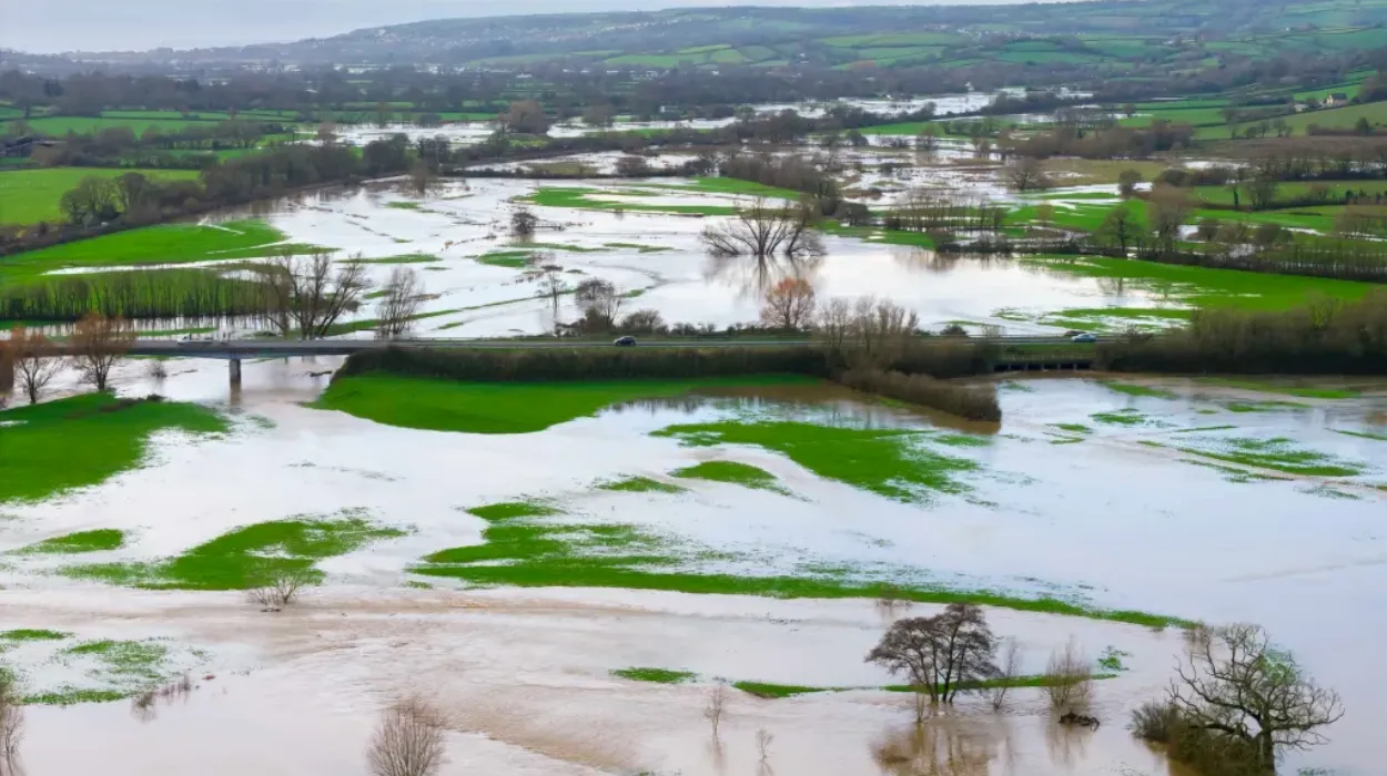
Residents in affected areas are advised to prepare a flood plan and an emergency kit. Travelers are also urged to check their routes in advance as heavy rain continues, with authorities warning that fast-flowing floodwater could be life-threatening.
The forecaster said,
“If the road is flooded, turn around and find another route. The leading cause of death during flooding is driving through flood water.”
It added,
“Just 30 cm of moving water can float a car, and flood water often hides hazards that can damage vehicles. Even a small amount of water entering an engine can cause severe damage.”
The Met Office also posted on X, saying,
“Take care when travelling in heavy rain, even moderate rain can reduce your ability to see and be seen. Please don’t walk or drive through flood water.”
Take care when travelling in heavy rain, even moderate rain can reduce your ability to see and be seen.
— Met Office (@metoffice) December 17, 2025
Please don't walk or drive through flood water.
Take a look at some of our tips and advice to stay #WeatherReadyhttps://t.co/FIGchvYB90 pic.twitter.com/pkhpGoY2Ss
Rebekah Hicks, Chief Forecaster at the Met Office, said,
“Low-pressure systems will bring further unsettled weather to the UK this week, with strong winds and further heavy rain at times over the next few days.”
She added,
“Today (Wednesday) brings periods of rain, which will be heavy at times, especially over high ground in the west of Britain. Coming off the back of recent very wet weather, some travel disruption and flooding is likely across parts of southwest England and south Wales. It will also become widely windy throughout the day too, with gales in some coastal areas.”
What did the Met Office forecast for the weekend and Christmas week in the UK?
The Met Office predicts Friday will bring a mix of sunshine and showers, particularly heavy in northern areas of the UK, with a risk of hail and thunder in northwest Scotland. A brief calmer spell is expected before another low-pressure system moves in.
According to the forecaster, western regions will experience further rain on Monday, while eastern areas remain mostly dry with sunny intervals. Temperatures are expected to stay near average.
Commenting on the weekend’s weather, Tom Crabtree, Deputy Chief Forecaster at the Met Office, said,
“The weekend ushers in another area of low pressure, which could bring further heavy rain and unsettled conditions.”
He stated,
“Central and eastern areas start off dry and bright, but another band of rain moves in across western parts, which could be heavy at times. With areas like south Wales and the southwest already sensitive to more rainfall, we’ll be monitoring this closely. Keep checking the Met Office forecast for the latest.”
Referring to the Christmas week weather, Mr Crabtree added,
“High pressure is expected to build into next week, bringing drier and less mild conditions for the Christmas period. Although temperatures will drop, they are not plummeting. Overnight frosts are likely, and some mist and fog is possible in places, but significant cold weather looks less probable. Falling temperatures do bring the potential for some wintry showers in the east, but it is too early to discern details for any particular day over the Christmas period.”
How many floods hit the UK in 2025?
In 2025, the UK experienced several significant flooding events, primarily driven by intense storms and prolonged rainfall.
On New Year’s Day, extensive flooding hit parts of England, Scotland, and Wales, with nearly 1,000 people evacuated in Greater Manchester.
In early January, severe weather caused major incidents in the Midlands and Northern England, while late January saw Storm Eowyn bring heavy rainfall and flooding in Devon.
On February 23, amber rain warnings were issued for south and mid-Wales, while summer storms triggered yellow flood alerts across Scotland, south Wales, and much of England.
Early December’s Storm Bram exposed weaknesses in England’s flood defences, while mid-December heavy rain triggered new flood warnings across the country.