
UK (Parliament Politics Magazine) – Devon campaigners demand public riverbank access after discovering the River Dart has 108 separate owners, raising concerns over walking rights.
As reported by The Guardian, Devon residents are pushing for public access to the River Dart after discovering it is divided among 108 owners, with offshore firms controlling one-eighth of its length.
How did the river walk plan clash with private ownership?
Residents carried out detailed research using site visits, angling maps, Companies House records, and Land Registry data to uncover the ownership of the River Dart.
The government pledged in last year’s manifesto to introduce nine new “river walks” across England to enhance public access, after reversing its earlier commitment to enshrine a legal right to roam.
The government has yet to publish details about the proposed river walks, neither the locations nor the practical steps for implementation have been confirmed. Devon campaigners argue their research highlights how challenging it is to secure landowner approval for public riverbank access.
What did campaigners discover about access to the River Dart?
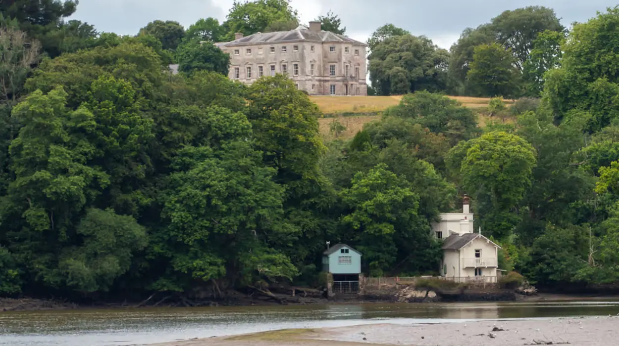
Nearly 100 miles of the River Dart’s banks are closed to the public. A major part of the land remains in private hands, with the Duchy of Cornwall holding 28 miles.
The Spitchwick estate is the second-largest landholder along the River Dart, handling 12 miles. The Duke of Somerset controls just over a mile, while another 11.6 miles are registered to offshore firms.
Campaigners are renewing calls for the right to roam, urging aristocratic landowners to allow public walking access.
Dozens of right to roam campaigners entered the Duke of Somerset’s private estate, holding a defiant picnic, playing music, and ignoring “keep out” signs in 2021. They cited Scotland as a model, where open access laws allow people to walk across the countryside as long as they act responsibly.
Research by British Canoeing shows that fewer than 4% of rivers in England are legally open for the public. England’s rivers are controlled by a patchwork of private owners, some holding just a few feet of land. Campaigners said that without land reform, public access will continue to be limited.
What did Lewis Winks discover about the ownership of the River Dart?
Lewis Winks, who conducted the study on the River Dart, stated,
“The River Dart is rightly a much-celebrated part of the Devon landscape, yet the rights to the river – and those who own them – largely remain a mystery. The more time I spend with the Dart, the more urgent the question becomes: who gets to decide whether we are able to know and love this river?”
He said he undertook the complex task of tracing land ownership along the river to find out who controls public access.
Mr Winks stated,
“What quickly became clear was how little transparency exists – even those working closely with the river often don’t know who owns the banks.”
He said,
“The situation along other, longer rivers is likely to be even more complex. Achieving increased access to rivers based on a permissive approach would present a logistical nightmare. Each stretch would require time-consuming negotiations with dozens – if not hundreds – of large landowners and corporate bodies, many of whom are difficult to identify.”
Mr Winks added,
“That’s why we’re calling for a rights-based approach to river access – similar to the system in Scotland, where the public has the right to responsibly walk, swim, paddle and canoe along most rivers and lochs, with sensible exceptions.”
DEFRA’s views on protecting nature and river access
A Department for Environment, Food and Rural Affairs spokesperson stated,
“Britain is a proud nation of nature lovers, and this government is committed to turning the tide on its decline after years of neglect. We are progressing plans to designate nine new national river walks, one in each region of England.”
Biggest rivers in the UK
- River Severn – 354 km (longest in Britain)
- River Thames – 346 km (longest in England)
- River Trent – 298 km (major Midlands river)
- River Great Ouse – 230 km (longest in East Anglia)
- River Wye – 215 km (forms part of the England-Wales border)