LONDON (Parliament Politics Magazine) – Temperatures are set to rise at about 30° C around the conclusion of the coming week, according to interactive weather maps (July 8). Although there are early indications that the humidity may persist, the forecaster has been hesitant to determine if a heatwave is likely.
Only when high temperatures persist for three days or longer is it officially considered a heatwave. There must be a temperature increase above the county-specific heatwave temperature threshold.
These records do not take one-off hot days into account.
There is a good probability that temperatures will surge to above average over the first fortnight of July, according to the Met Office’s latest forecast.
In a statement to Express.co.uk, spokesman Oliver Claydon said that as they entered July, there were early indications of a period of more settled weather, with high pressure possibly establishing itself to the south of the UK, but likely spreading to all areas at times.
With those more stable circumstances, temperatures would rise and were expected to occasionally be above average, particularly in the South East, where they could see temperatures as high as the 20°s, he added.
Temperatures would often be closer to average in the North, where there would be some unsettled conditions.
However, that was still some time away, and with unsettled conditions lingering for the majority of the rest of the current week, absolute maximum temperatures next week would be subject to quite a bit of uncertainty for a while still, he said.
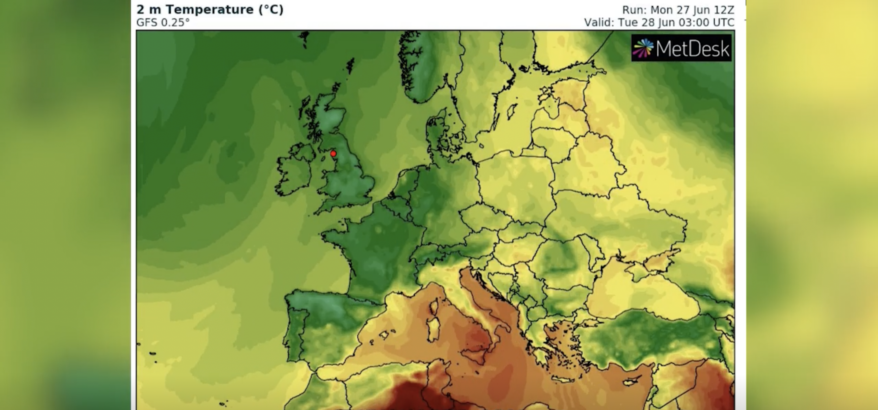
Temperatures are expected to reach over 25° C starting on Sunday, July 3, according to WX Charts maps.
But a scorching plume from northern Europe will come in across the English Channel on Thursday, July 7.
Maps currently show 28°C to 29°C, but temperatures are expected to reach 30°C in the south east.
The weekend (July 9 and 10) is also expected to see these highs until they begin to decline by Wednesday, July 13.
The long-range forecast from the Met Office for this time period states that while more settled conditions would begin to take hold across the south at the start of the period, it would remain generally unsettled in the north, with cloud and rain in the northwest moving south through Saturday, but weakening.
The south and southwest would largely remain dry into the following week, but the danger of more erratic weather, with showers and occasionally longer periods of rain, persists in the north.
Eastern and southern regions were probably going to be dry, although there was a small chance of the occasional, isolated shower. In the north, temperatures were predicted to be near or a little below normal, but higher than normal in the south, Oliver Claydon added.
But this week’s temperatures will be significantly milder before the heat sweeps most of the south east.
By the end of this week, the temperature in downtown London will exceed 20°C, and early predictions indicate that it will gradually increase by the start of the following week.
This Thursday, June 30, there will also be a little rain, which will make it feel much colder than it has in recent weeks.
Image via Express